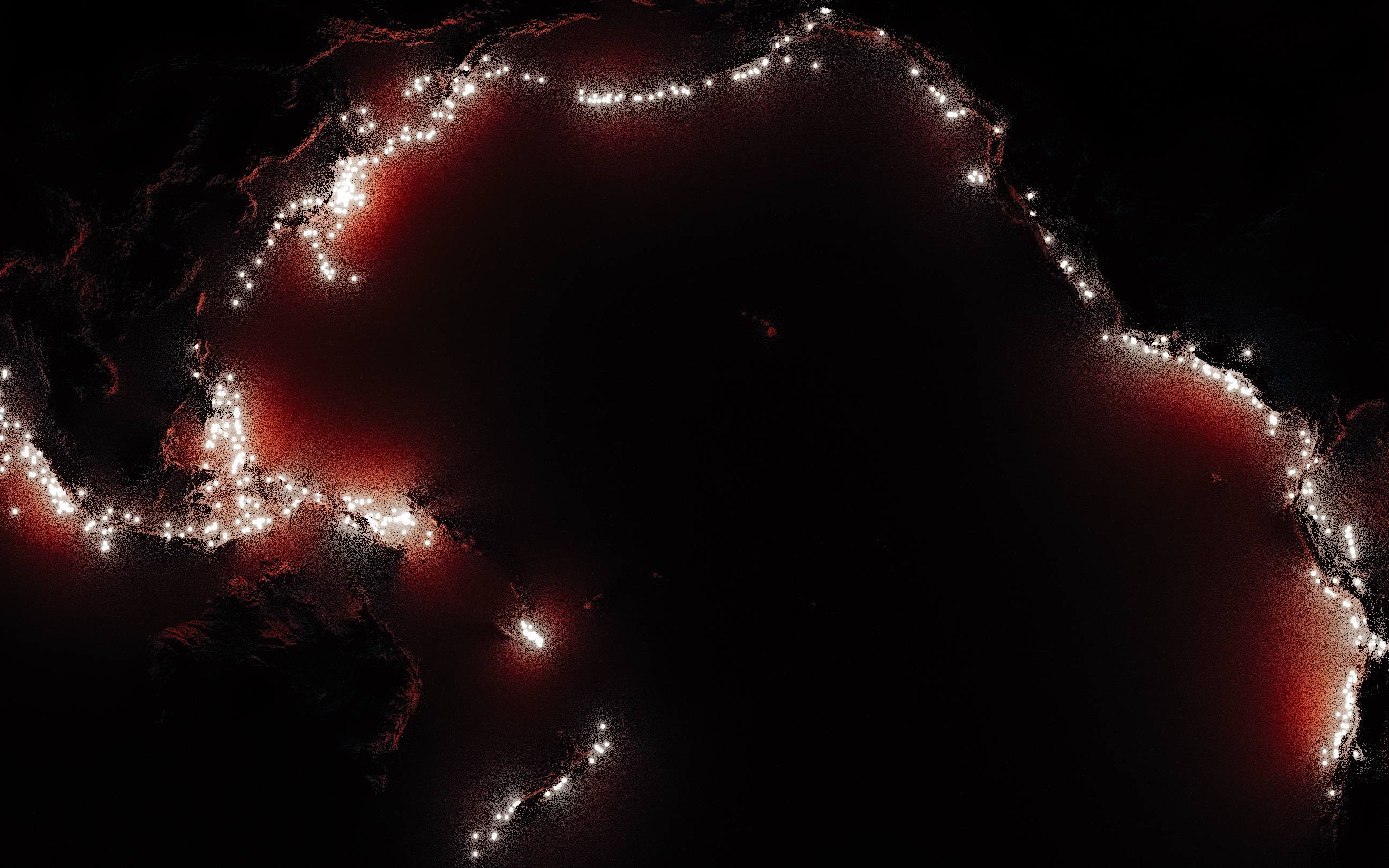
of M4+ events fall within 800 km of our guide
The Pacific’s Broken Ring
The Ring of Fire is easy to see but hard to draw
It forms where large, solid pieces of Earth’s outer layer meet and move. These pieces are called tectonic plates. In many places, one plate moves beneath another and sinks into the mantle, creating deep ocean trenches, volcanoes, and earthquakes far below the surface.
The name describes a broad and uneven zone rather than a perfect circle. Geologists have no single official boundary for it, so the number of earthquakes depends on their size, the time period, and the area being counted.
of the world's largest earthquakes occur in the circum-Pacific belt
of Holocene volcanoes sit in its 41 volcanic regions
01 The edge
How wide is a ring?
Move the boundary and see how the percentage changes. Each percentage is calculated from the full list of earthquakes in the USGS catalog. The map shows a fixed sample of these earthquakes, so the same points appear each time and the map should stays smooth on a phone.
A reproducible boundary
Distance from the circum-Pacific guide
Loading the earthquake sample
inside selected corridor
54.00%of catalogued M4+ earthquakes
193,677events caught by this width
02 The fire
The name comes from what happens along the edge
Much of the Pacific rim is built from subduction zones. Dense oceanic crust bends into the mantle, earthquakes rupture along and within the sinking slab, and magma feeds volcanic arcs above it
One plate boundary, seen from the sidePlates converge
Plates around the Pacific move toward, away from and past one another. Convergent margins make most of the famous horseshoe
The denser oceanic plate bends downward at a trench. Friction and rupture mark its path with earthquakes
Water carried down in rock and sediment helps melting occur in the hotter mantle above the slab
Buoyant magma rises and forms a chain of volcanoes on the landward side of the trench
57%of Holocene volcanoes
The Smithsonian count
687 volcanoes across 41 regions
The Global Volcanism Program records 1,214 volcanoes that have erupted during the Holocene, the geological period covering roughly the last 11,700 years. Of these, 687 are located in regions around the Pacific that belong to the Ring of Fire. The volcanoes make the belt visible, while the earthquakes reveal how tectonic plates move beneath the surface
See the Global Volcanism Program definition03 The depth
The ring continues almost 700 kilometres down
A flat map shows the earthquakes from above, but it hides their depth. Rotate the 3D map of earthquake points and the ring becomes a series of sloping bands that descend beneath the surface, showing where one tectonic plate sinks below another
142,283shallow, below 70 km
45,916intermediate, 70 to 300 km
5,113deep, 300 km or more
Interactive point cloud
Ten arcs, viewed from below the surface
Loading 12,054 representative events
Drag to tilt. Scroll or pinch to zoom.
SelectedAll arcs
Median depth35.0 km
Deepest event686.4 km
The same ring, different slabs
Depth changes from arc to arc
Each bar ends at the 90th percentile. This means that 90% of the recorded earthquakes are shallower than the bar’s end. The bright mark shows the median depth, where half the earthquakes are shallower and half are deeper. In this catalog, Cascadia has mostly shallow earthquakes, while the Andes, Sunda Arc, and Tonga to New Zealand reach much greater depths
USGS classifies earthquakes from 0 to 70 km as shallow, 70 to 300 km as intermediate and 300 to 700 km as deep. Events below 70 km occur inside slabs of lithosphere sinking into the mantle.
04 The scale
The catalog contains mostly small earthquakes but a few very large earthquakes release most of the total energy
Magnitude is measured on a logarithmic scale, so a one point increase is a very large jump. An earthquake that is one magnitude higher releases about 31.6 times more energy. In this catalog, earthquakes at that higher magnitude are roughly ten times less common
Magnitude frequency
Choose a minimum magnitude
Fitted b value 0.97
Events in 26 years22,943
Average per year882.42
Share of estimated energy99.5%
Energy concentration
Two events account for about 43%.
The 2004 Sumatra-Andaman and 2011 Tohoku earthquakes both reached magnitude 9.1. Together, they account for about 43.3% of the estimated energy released by the 193,312 earthquakes in this corridor
largest twonext eightremaining 193,302
05 The pulse
A few huge earthquakes light up the record
Each vertical line below represents one day. After a large earthquake, smaller aftershocks can continue for weeks, so the record stays busy even after the original earthquake
9,497 days
Daily M4+ earthquakes inside the corridor
Selected rupture
M9.1
2011 Great Tohoku Earthquake, Japan
11 March 2011 at 05:46 UTC, 29 km deep
Counts include M4+ catalog events within 500 km after the main event. They are a proximity measure rather than a formal aftershock classification.Field guide Around the Ring
Four cool places that worth visiting
On the map, the Ring of Fire looks like a line but on the ground, it appears as lava fields, crater lakes, young forests, and cities beneath active volcanoes. Four places show how the same plate boundary can shape very different landscapes
Sakurajima
A short ferry ride from Kagoshima ends at lava fields, an ash buried shrine gate and one of Japan's most active volcanoes
Plan the visitTongariro
On New Zealand’s North Island, young craters, old lava flows, and steaming ground show the effects of the Pacific Plate sinking beneath the Australian Plate
Explore the parkMount St. Helens
In 1980, an eruption transformed the landscape around this crater in minutes. Move through the scene to see how the forest has returned over the years
Visit the monumentVillarrica
Araucaria forests and solidified lava flows climb toward an active, ice-capped cone above the lakes of southern Chile.
Discover the parkBuilt with love and curiosity by Edo Danilyan using R, Quarto, D3, rayshader, and Canvas