JAVA, INDONESIA / A guide to people living near volcanoes
Millions of people live near volcanoes on Java.
Java has 31 Holocene volcanoes and around 147.0 million people. People farm volcanic slopes, build cities nearby and visit the craters. This page shows how close people live to the volcanoes and which information distance does not provide.
31 Holocene volcanoes on Java
60.0 million People live within 30 km of at least one volcano
41% of everyone on Java lives inside that outer band
The road starts to climb
Drive out of a city on Java’s north coast and the road soon starts climbing. Rice fields are gradually replaced by clove and coffee farms, and the air gets cooler. At some point, the ground changes from river soil to old lava and ash. There is no sign marking the location.
A chain of volcanoes crosses the middle of Java. The soil is good for farming, water collects on the slopes, and the lower areas have space for roads, towns and cities. These conditions are some of the reasons people live close to the volcanoes.
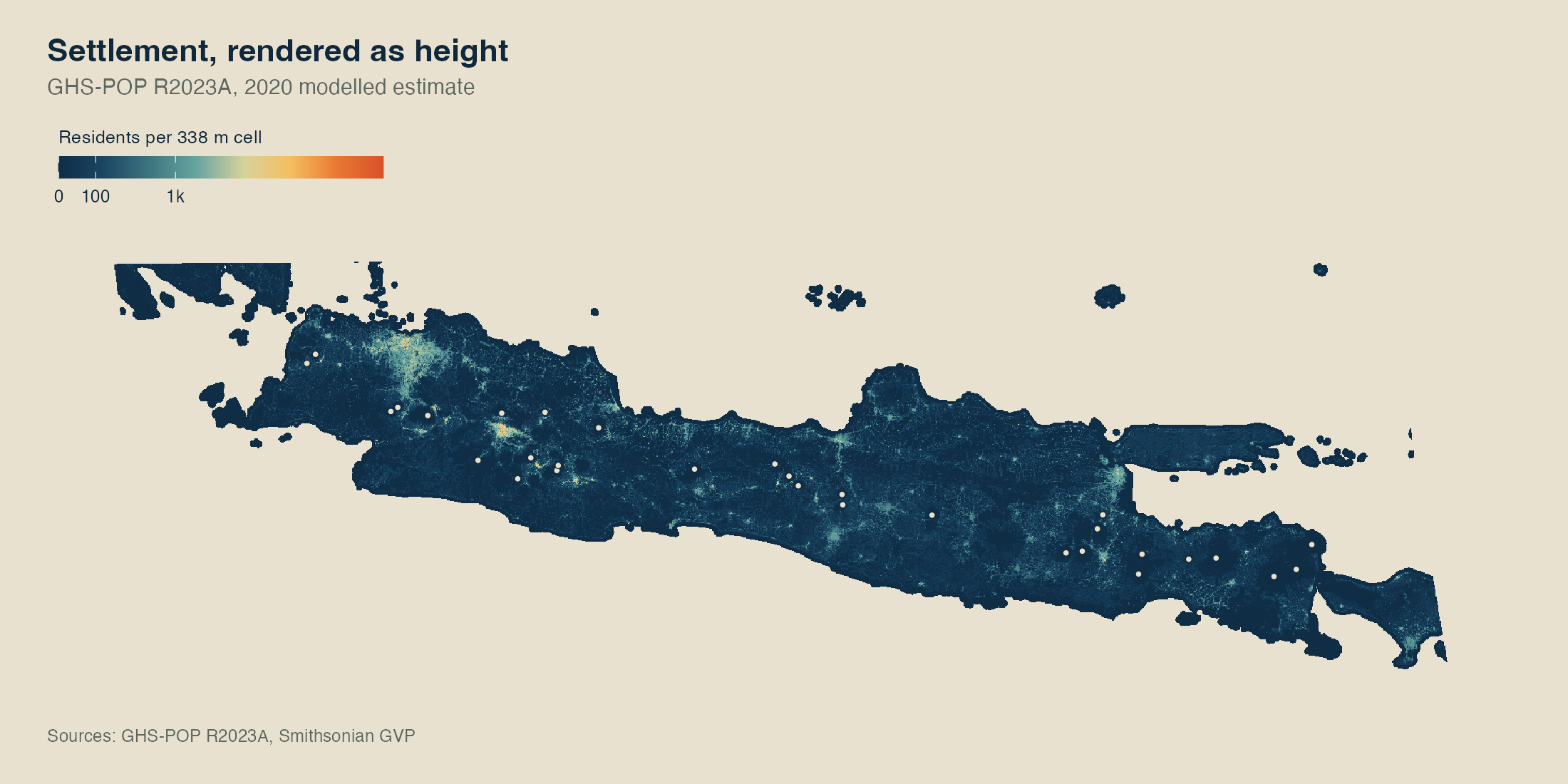
The first map shows the location of each volcano in relation to nearby towns and cities.
Figure 2. This map shows Java’s 31 Holocene volcanoes. Hover over a marker to see the volcano type, its location and how many confirmed eruptions GVP records since 1900. Terrain comes from Copernicus DEM GLO-30, volcano records come from Smithsonian GVP, and boundaries come from GADM.
Population shown as height
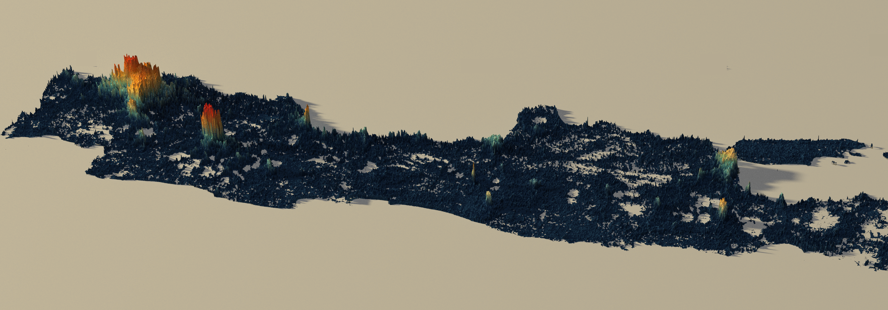
Population data is stored as a grid. Each square contains an estimate of how many people live there, without city names or streets. In the opening image, the height of each square is based on that estimate. Higher areas mean more residents.
A higher peak means more people live there.
The largest population groups are on flatter land near volcanic slopes, roads and cities. People live there partly because volcanic soil is suitable for farming and water collects on the slopes.
03 / People near volcanoes
The volcano with the most people nearby
The population count is highest around one volcano. It is not the tallest volcano. Its location beside a large urban area places many people within the distance rings.
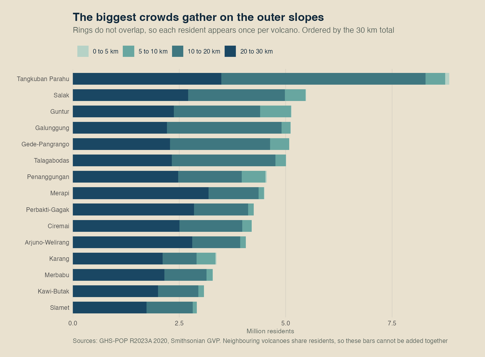
That volcano is Tangkuban Parahu. Around 8.8 million people live within 30 kilometres of it, and about 97,000 live within the nearest 5 kilometres. That inner ring has about 1,230 people per square kilometre. This is close to the 2020 population density of Phoenix, and a little below Houston or Atlanta when each city is measured within its official boundary. A city-sized crowd lives around an active volcano.
Tangkuban Parahu is on the north side of the Bandung metropolitan area. Visitors can use a paved road that ends near the crater rim. On 26 July 2019, a sudden eruption sent ash around 200 metres above the summit, and visitors left the tourist area. The volcano is easy to reach from Bandung, while millions of people also live nearby.
Living five kilometres from a summit is not the same as living twenty or thirty kilometres away. Someone farther away may still be downstream or downwind. A road along a river valley may also lead from their home toward the volcano.
Limits of distance circles
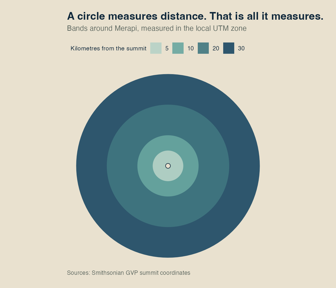
Circles make the volcanoes easy to compare because we can use the same distances for all of them. However, the areas affected by eruptions are not circular.
When Merapi began erupting in October 2010, the official danger zone did not stay fixed. It extended 10 kilometres from the summit on 25 October, then grew to 15 kilometres and finally 20 kilometres. A few hours after that last change, pyroclastic flows and surges travelled as far as 15 kilometres down the slopes. The USGS account estimates that the final expansion saved between 10,000 and 20,000 lives. Officials changed the danger zone as conditions changed.
We use the rings to answer one question. How far is a home from the summit? They do not tell us where an eruption might go, who would be in its path, or whether people could get away in time. Distance, hazard and risk are related, but they are not the same thing.
Pyroclastic flows travel through valleys, lahars travel through rivers, and wind carries ash. One night in June 1982, a British Airways 747 flew into ash from Mount Galunggung and lost power in all four engines at 37,000 feet. The plane dropped to 12,000 feet before the crew restarted three engines and landed in Jakarta. NASA’s account confirms those figures. The distance circles used here do not identify unsafe airspace.
Why some people are counted more than once
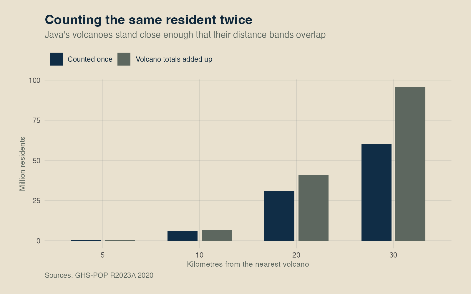
Draw these circles across Java and they soon overlap. A village can be close to two volcanoes, while parts of a city can fall within several outer rings. If we calculate the population around each volcano separately, we count some people more than once.
Adding the separate population totals gives us 95.7 million people within 30 kilometres. After joining the overlapping areas and counting each populated square once, the total becomes 60.0 million. That is the number used on this page.
Three volcanoes and the people around them
At the island scale, the volcanoes can appear similar. At the local scale, each volcano has a different shape, and people use the surrounding land in different ways. These three images use the same frame, light and scale so we can compare them.
Merapi
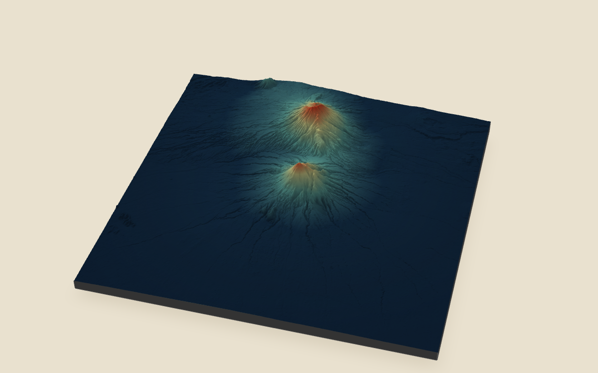
Indonesia’s geological agency lists Merapi at 2,968 metres. The population data estimates that around 4.5 million people live within 30 kilometres.
Semeru
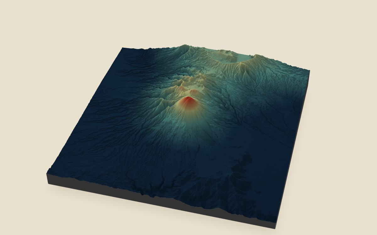
Indonesia’s geological agency lists Semeru at 3,676 metres. The population data estimates that around 1.2 million people live within 30 kilometres.
Tengger Caldera
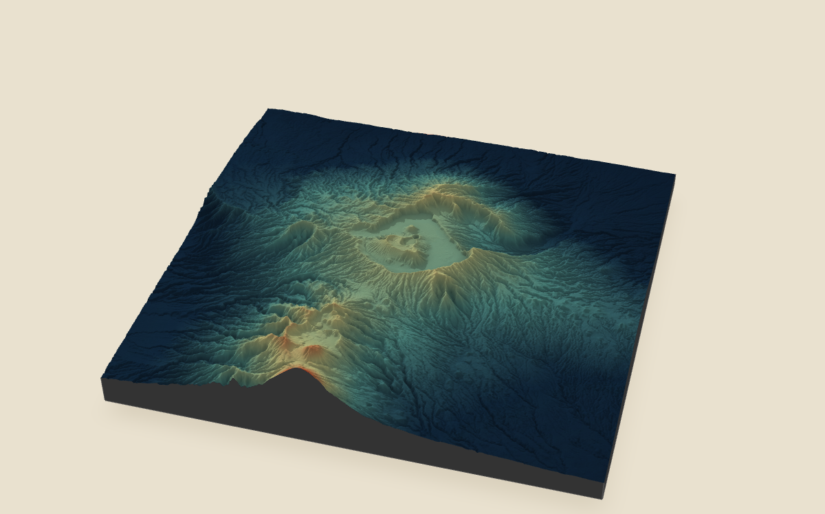
Bromo is the active cone inside Tengger Caldera, and Indonesia’s geological agency lists it at 2,329 metres. The population data estimates that around 1.4 million people live within 30 kilometres.
Merapi is near Yogyakarta. For generations, a gatekeeper appointed by the Yogyakarta palace has led rituals and connected the palace with communities around the mountain. Mbah Maridjan took over from his father in 1982. He died at his home in Kinahrejo when pyroclastic flows reached the village in October 2010 after he decided not to leave.
Water from Semeru flows through valleys used for farming and sand mining. On 4 December 2021, pyroclastic flows travelled 16 kilometres towards Besuk Kobokan. PVMBG records 51 deaths, which matches the final number reported by BNPB.
At Tengger Caldera, tour buses bring visitors to Bromo for sunrise through much of the year. During the yearly Yadnya Kasada ceremony, the national park closes the site to outside visitors so the Tenggerese can hold their rituals. They bring food, farm produce and livestock as offerings at the crater.
Communities near these three volcanoes have different activities and traditions.
07 / Limits of the numbers
The distance calculations show that many people live near Java’s volcanoes. They do not identify who would be affected by an eruption, how fast a lahar might arrive, or whether a family could leave in time.
Tangkuban Parahu, Salak, Guntur, Galunggung and Gede-Pangrango account for 39% of everyone living within 30 kilometres of a volcano on Java. Only 1% of that group lives within the nearest 5 kilometres.
Most people in that total live farther from the summits. They may still be affected later or from a specific direction. An evacuation plan covering only the nearest few kilometres would not include many of them.
Different choices change the order
Changing the circle size, population year or grid detail changes the ranking order. The biggest difference occurs with radius 3 km, where the rank correlation with the main ranking is 0.206.
The exact order changes, especially at short distances. However, the largest population totals are still found in towns and cities near volcanic land.
This project was developed from December 2025 to August 2026. It uses GHS-POP R2023A population estimates for 2020, volcano records from the Smithsonian Global Volcanism Program, terrain from Copernicus DEM GLO-30 and boundaries from GADM. Linked facts were last checked on 4 August 2026.
Built with love and curiosity using Quarto and R by Edo Danilyan.